South Mississippi Weather: Weekend Frost Threat Looms After Crisp Monday
Coastal residents face a warm mid-70s afternoon today before a cold front drops weekend highs into the 60s and risks killing tender plants.
By Robert Ward ·
Residents in South Mississippi will experience a sharp temperature swing this week, moving from a mild Monday afternoon to a potentially frost-covered weekend. While the immediate change offers a brief window of comfort, the coming days bring conditions that could affect outdoor gardening and morning commutes for working families.
Most communities woke up Monday in the 40s, with a few coastal locations, including Biloxi and Keesler Air Force Base, remaining in the 50s. Temperatures are set to rise to the mid-70s by Monday afternoon, a range that aligns closely with typical November averages. Skies will hold a few passing clouds, but no rain is expected, creating a dry and pleasant environment for outdoor activity.
The comfortable weather is temporary. Temperatures will fall back to the 40s and 50s from Monday night into Tuesday morning. Areas north of Interstate 10 will generally see the 40s, while cooler readings may push closer to the coast near Pascagoula. Residents should keep jackets handy for the Tuesday morning commute and school drop-off. Rain chances sit at 10% on Tuesday, increasing to 20% at times from Tuesday night into Veterans Day Wednesday. Any precipitation is expected to be limited.
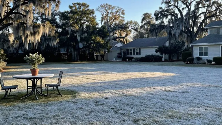
A cold front will arrive before the weekend, ushering in much colder air. Highs are projected to drop into the 60s from Friday through the weekend. By Saturday morning, frost could develop in parts of South Mississippi. The greatest risk exists in Pearl River, Stone, and George counties, along with the northern sections of Jackson, Harrison, and Hancock counties. Gulfport and Biloxi may escape the worst of the freeze, though conditions remain variable.
Gardeners and residents with sensitive outdoor plants must act before Friday night. Frost formation requires cold temperatures, clear skies, and calm or light winds. The weekend forecast depends on how these specific conditions align. Those with tender plants should plan to bring them indoors or cover them if the outlook looks likely.
The shift marks a distinct cooling trend for the region. While Monday offers a rare warm afternoon, the coming weekend will test the limits of local flora and require residents to prepare for colder mornings.